This paper was presented at the New Forest Knowledge Conference 2018 entitled: The Role of Commoning in the Maintenance of Landscape and Ecology: A New Forest, National and Global Perspective.
Speaker:
Jenny Phelps, Farming and Wildlife Advisory Group, South West
Abstract
There is a widespread recognition that there have been dramatic changes across the countryside in the UK over the past 70 years. Currently environmental land management initiatives tend to be top-down, driven by large institutions citing national legislation, policy obligations and international Directives and Conventions. Local communities, including farmers, who may nevertheless feel protective of the natural assets within their vicinity (that may also make a considerable contribution to a local sense of identity), may feel alienated from the imposition of targets relating to these same assets from whose formulation they have been excluded. However, such communities frequently have essential knowledge, experience and a sense of pride and commitment to the future survival of such areas. Furthermore the range of national organisations, strategies and policy frameworks can sometimes end up working against each other in a particular area. This is particularly true of complex sites and issues that contain a wide range of legal obligations and other interests. In such multi-objective areas there is a real need for greater connectivity at all levels, local, regional and national, to enable a synergy to be possible on the ground. This lack of co-ordination, coherence and integration at the national (and even regional) level results in a series of confusing, disjointed and contradictory signals and mechanism for those who live and work close to these areas and, most importantly, have the capacity to assist in their management and governance.
While it is possible to see how these tensions have developed, largely through the shift in power away from productivist agriculture and towards measures aimed at halting environmental decline, the need to embrace a holistic multi-objective approach that inspires and enables farmers and local communities is pressing. The international institutions without the engagement of local people, who feel distanced and even disenfranchised from their own land as a result, undermines the environmental imperative. Within Gloucestershire, the Farming and Wildlife Advisory Group (FWAG) have been developing an integrated local delivery (ILD) model, implemented in a range of situations that utilises and enables those with local skills and environmental land management knowledge that contributes to the management of sensitive and key environmental sites.
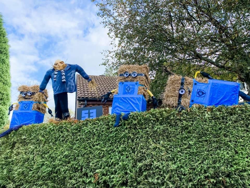
It first started in 2021 as a way to raise some money for the local infant school St Michael & All Angels in a way that was covid friendly as it was still a little bit like that at the time. The first year we had around 50 scarecrows and raised £1273 for the school. The event blew us away in how popular it was. We had 250 maps printed for it which sold out the first day and we spent a manic Saturday night trying to beg anyone local with a colour printer to print us some copies. During and after the trail there was growing feeling in the village that we simply HAD to make it an annual event. Due to people coming into Lyndhurst to hunt down the scarecrows there was a real boost in trade for all the local businesses on the high street too which was an unexpected bonus. The winner of our first year was ‘Gru and his Minions’ which was an epic creation on display in Haskells Close.
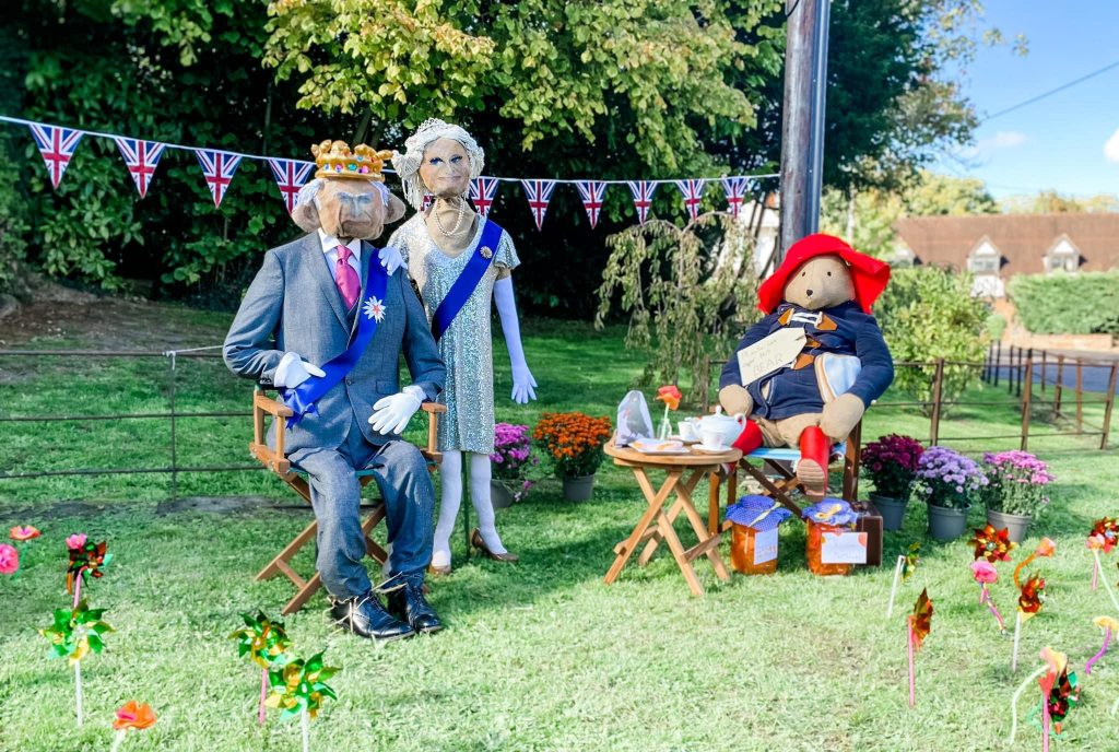
The 2nd year we had 85 scarecrows and raised £1800. The worthy winners of the 2022 trail were King Charles, Camilla and Paddington who were on display on the green in Forest Gardens. The residents of this street club [came] together to create their entry and also sold homemade cakes and marmalade to raise additional funds for the school. The community spirit was really out in full force this year.
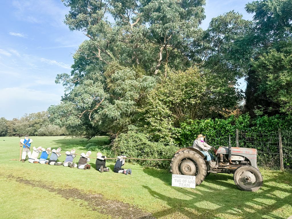
It returned again in 2023 with 80 scarecrows and the addition of the Barn Dance held at The Stag, Lyndhurst. On the Saturday night of the trail weekend they had a traditional Ceilidh band and this saw villagers old and young all come together to dance and have fun, it was a great night that raised over £200 for the trail. Forest Gardens did us proud again and held a Mad Hatters Tea Party. Along with their amazing scarecrows of Alice and friends they served sandwiches, cakes, drinks and more to raise an incredible £837.50 for the school! The total raised for the 2023 trail was an amazing £3144 and the winner was ‘The Lyndhurst Tug of War’ featuring no less than 9 scarecrows!
The donations we have raised have contributed to an outside library for the children at St Michael’s, funded much needed new iPads for the school, a new reading scheme, paid for pantos and discos put on for the children and more. This year the 20 year old tricycles are in desperate need of replacing as they are not fit for use so we hope to use the money from the trail to pay for them.
The following contribution was written by New Forest Heritage Centre volunteer Chris Blake.
The grave of ‘Admiral Sir Charles Burrard’ at St Michael & All Angels in Lyndhurst was recently restored by the Napoleonic and Revolutionary War Graves Charity. This is part of an initiative to ensure stories like his are not forgotten. Fortunately, Admiral Sir Charles Burrard and his family preserved their story in sketchbooks, held in the New Forest Heritage Centre.
Charles Burrard was born into a military family in 1793, third in line to inherit the baronetcy of Lymington. He joined the Royal Navy at the age of 11 , in 1805. By 1806 he was aboard HMS London as a Midshipman. This was during the Napoleonic Wars, months after the Battle of Trafalgar. In the morning darkness of the 13th March, French commerce raiders mistook the ships of his squadron for merchantmen. Before the French surrender, 10 men had been killed and 22 wounded aboard HMS London during hours of thunderous gunfire. Burrard later painted this event from a removed third-person viewpoint.
Shortly afterwards, Charles was transferred to HMS Victory. In January 1809, the Victory escorted transport ships to La Coruña, to evacuate British troops following their desperate retreat to the coast of Northern Spain. Charles’ eldest brother was ashore, serving as Aide de Camp to Lieutenant-General Sir John Moore. During the battle to defend the port and the possibility of evacuation, Charles’ brother was killed. It is likely that Charles was in the harbour at the time.
That October, his surviving older brother (also a Midshipman in the Navy) was drowned after his boat capsized near Weymouth. Charles was now unexpectedly first in line to inherit, aged about 16, having lost his older brothers. As the eldest son of a Baronet, he was entitled to a knighthood. Sir Charles was promoted to Lieutenant after three years and served in actions around the Mediterranean.
Sir Charles’ father died in 1813, apparently from a heart broken by the news of his other son’s death at the Siege of San Sebastian. Charles was now 2nd Baronet Lymington.
The following years saw his first commands, and the end of the Napoleonic Wars. He rose through the ranks of the Navy, and was often in the Mediterranean. There he met his future wife, Louisa Lushington, daughter of the British Consul-General in Naples. They married in 1826, returning to England in 1827.
Sir Charles was then pensioned out of the Navy aged 34, as a ‘Superannuated Captain’. A naval officer promoted to Captain was entitled to lifelong promotion in strict order of seniority, regardless of functional demand for higher-ranking officers. Sir Charles Burrard was promoted for the rest of his life, eventually becoming an Admiral.
He spent the rest of his life in and around the New Forest raising a large family, though he was ultimately the last Baronet Lymington. He and his wife likely helped teach their children to paint and draw. They dedicated these decades of peace to the Church, and the creation of an extraordinary painted archive of rural nineteenth century Hampshire.
The following contribution was written by New Forest Heritage Centre volunteer Chris Blake.
Born in 1902, Félicité Hardcastle grew up in Oxfordshire but had moved to Burley by the time she was 18. She lived there until she died in 1988, by which time she had become an established local historian and amateur botanist, and had been awarded the British Empire Medal for services to the community. The award citation described her as the ‘grand old lady of the New Forest’, but she immersed herself in village life in Burley before she was 20. She was particularly involved in the Scout movement as a longstanding Cubmaster and eventually Assistant District Commissioner. During WW2 she volunteered as a telephonist in Burley, assisting with the running of nearby military bases.
She was involved in numerous local clubs and societies, taught in the Sunday School, became a School Governor, and served on the Parish Council. Whilst on the Council she was particularly active in protecting Rights of Way. She recorded her detailed historical research in a book titled Records of Burley, and was involved in many archaeological excavations within the New Forest. Her passion was the accessible preservation of heritage for local communities, and the encouragement of young people. As a result, she lectured widely on local history and natural science at village events and Avon Tyrell youth centre. Her research notes, photographs, and letters were made publicly accessible at Hampshire Record Office after she died. These are now kept at Christopher Tower Reference Library in Lyndhurst, and act as testament to “Miss Hardcastle’s” dedication to her community and the heritage of the New Forest.
The following contribution was written by New Forest Heritage Centre volunteer Chris Blake.
LGBT+ history has until recently been quite biased towards public figures whose lives were subject to greater public scrutiny, and whose private correspondence was archived. Most people in the New Forest have not historically lived such public, well-recorded lives. Irrespective of fame, many people in the past and present alike would prefer privacy from stigma and scrutiny, or would have chosen to focus their lives on different legacies within their local community. Unfortunately, before the decriminalisation of same-sex relationships in 1957, secrecy was also a very real imperative. Sometimes this literally involved burning diaries and letters. It is unsurprising that these details of people’s private lives have often not been preserved.
As a result, there are few openly LGBT+ life stories recorded in the New Forest Heritage centre archives. The late Lord Montagu of Beaulieu is largely represented by his contributions to the local community and the study of local heritage. However, the decriminalisation of homosexuality owes a lot to the inquiry that resulted from public response to his trial in the 1950s.
Thanks to that decriminalisation, LGBT+ people now have greater choice as to how they live those aspects of their lives. Stigma is still a persistent challenge, but that is after all why these stories must be told.
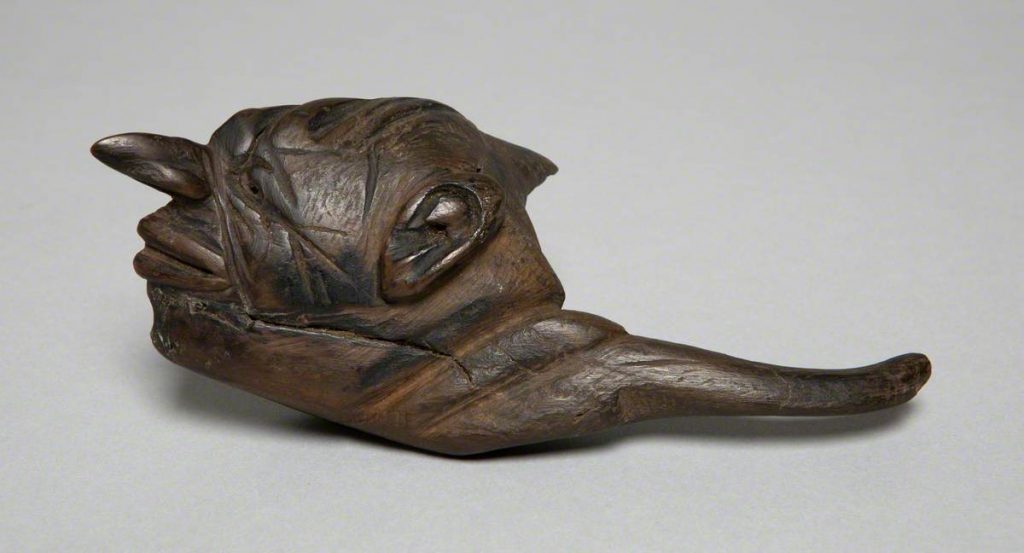
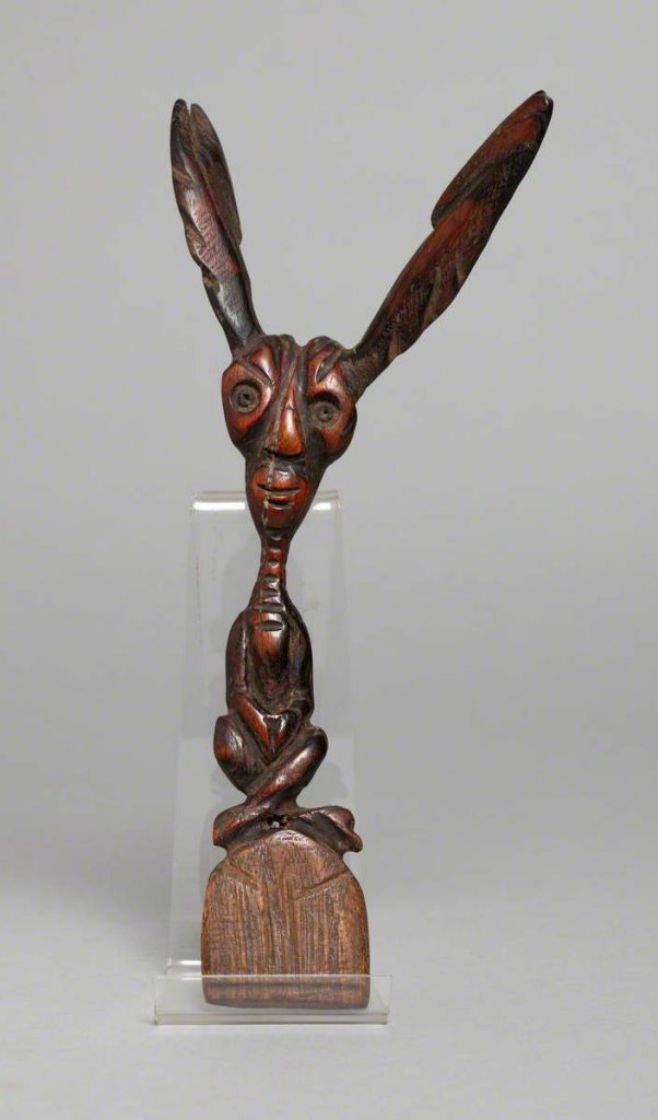
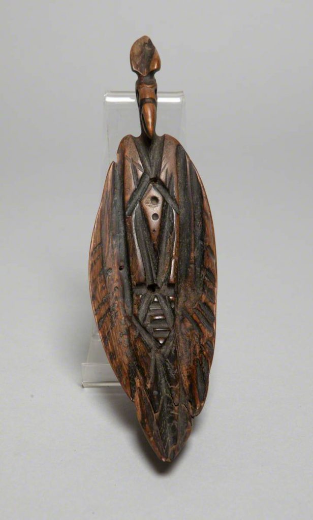
Tom Charman‘s curious wooden carvings and mysterious, visionary works of art draw us into the enchanting world of fairies and elementals – revealing the legacy of a Victorian fascination for clairvoyance.
Woodcarving of the head of a pixie by New Forest Artist Tom Charman
Born in Horsham, Sussex on 14th March 1863, Tom’s parents ran a grocery, his father from a long tradition in farming, and his mother an educated woman with a love of literature. At the age of seven, Tom records seeing a fairy riding a brown rat in his bedroom although he was not to see another for 30 years.
An idyllic childhood
Completing his formal education at the age of 12, Tom’s love of the extraordinary led him to visit the music halls; his secretive excursions were often concluded by a beating from his strictly Methodist father. When his mother fell ill and, as the youngest in a large family, he was asked to remain at home, he would often sit and read to her through the night, further advancing his education.
At five feet and six inches, Tom was described in his son’s memoir as ‘of wiry build, fair-haired with a handsome well-boned face; quite a dandy in his bowler hat, high wing collar and cane walking stick’.
Tom unsuccessfully tried his hand at several occupations, including a door-to-door sewing machine salesman. A natural showman, by 1887 his love of performing and the music halls were providing him with considerable success as a ventriloquist, mime artist and character raconteur; he travelled the home counties performing solo and in a vaudeville partnership with his friend Jack Pain.
Tom Charman and Jack Pain c.1887–1889
Meanwhile, his distinctive artistic flair, inspired by Aubrey Beardsley and the caricatures of Thomas Rowlandson, had already brought some success – an early illustrative commission of numerous drawings for Charles Roper’s 1895 book Whispers from Fairyland.
Tom outside a wigwam in the New Forest in summer
By the turn of the century, Tom had joined a group of actors, artists and society eccentrics in search of an Arcadian lifestyle in the New Forest. They followed the fashionable trends for travelling in horse-drawn caravans and a passion for the natural world. Among his collection of friends was the Reverend James Leith Macbeth Bain, the spiritualist minister known as Brother James and famous for the hymn tune Brother James’s Air. It was such connections and experiences which would dictate Tom’s artistic future.
Still determined to use his natural gift for illustration, Tom decided to seek his fortune in America, funded by a small legacy following his mother’s death, where he worked briefly on a New Jersey newspaper as a cartoonist. It was an unhappy and lonely experience. Unable to create and persuaded he was being poisoned by his landlord, he soon returned to Sussex.
Tom’s proclivity to see fairies as an adult – and his aptitude for clairvoyance – were revived when he reconnected with the New Forest in a move to Nomansland, near Bramshaw. By 1911, the 49-year-old Tom had arrived to help his sister Sarah and brother-in-law William Halls in their post office, grocery and bakery. He had recently completed the illustrations for Henry Burstow’s Reminiscences of Horsham (1911) in which his father Michael is mentioned as a bell ringer, but he was struggling to make a living.
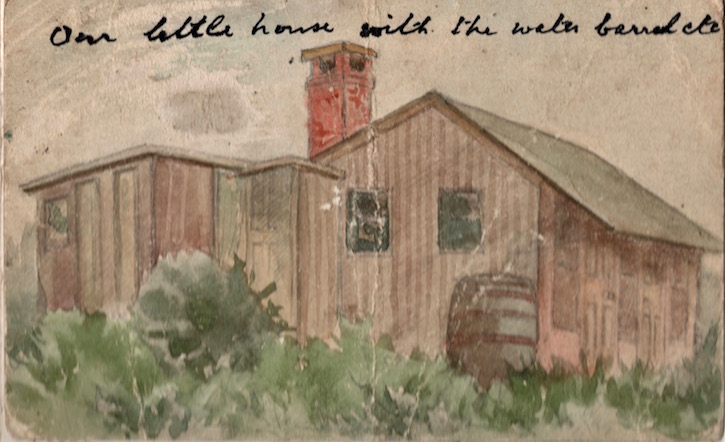
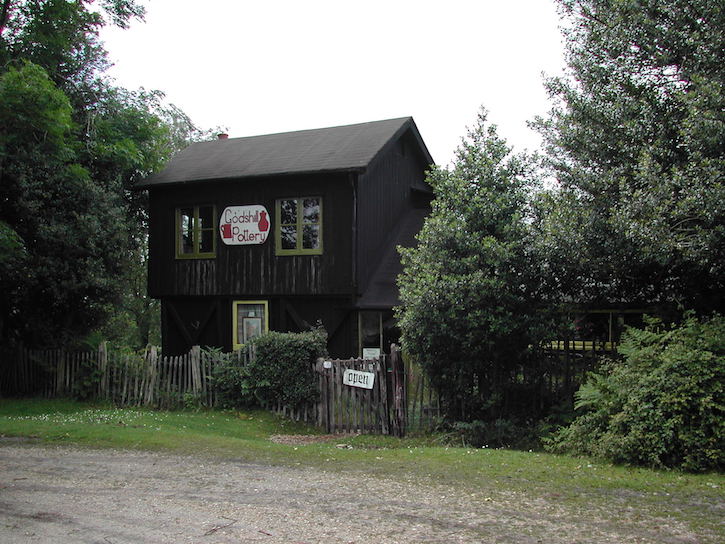
The Godshill Pottery bungalow
While walking in the Forest, Tom met the amateur geologist, anthropologist and Quaker Ernest Westlake, who was to found the Order of Woodcraft Chivalry in 1916 and set up a ‘Forest School’ on land at Sandy Balls, near Fordingbridge. Ernest had built a small wooden bungalow on The Ridge in Godshill and was living there, following his wife’s death, with his daughter Margaret and son Aubrey. Ernest and Tom discovered they shared many passions.
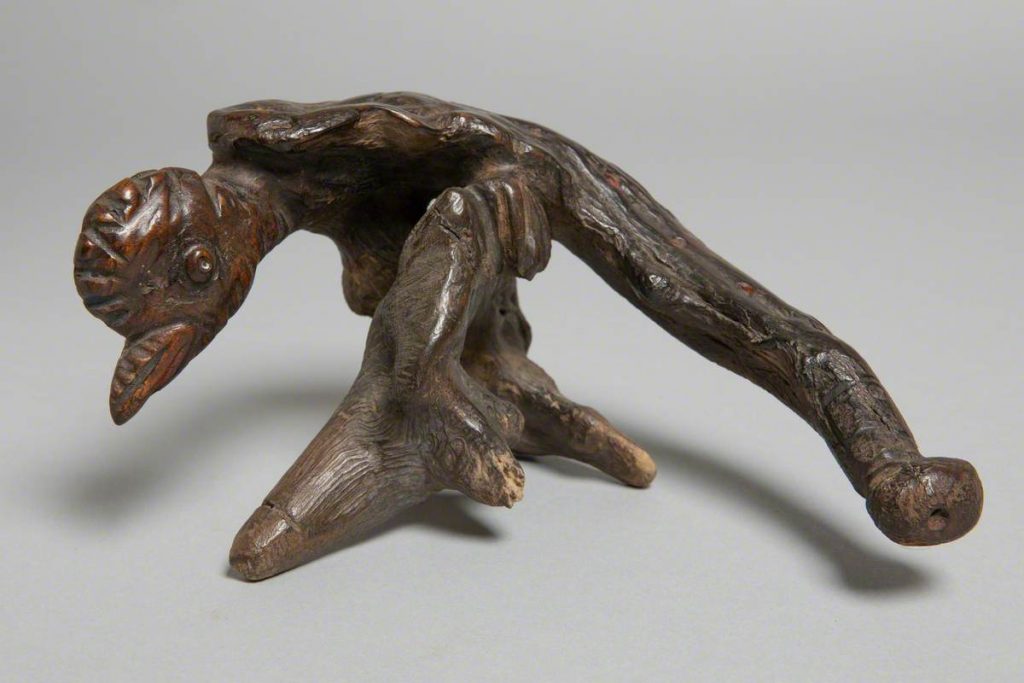
Stylised Figure Seated Cross-Legged with Large Ears by Tom Charman c.1919–1935
Inspired by the prehistoric charm and weird beauty of the New Forest, Tom produced literally hundreds of carvings, recreating the creatures and elemental spirits he perceived in the twisted roots, branches and twigs. He would also sit for hours drawing the ‘little people’ that appeared to him as he walked among the trees, and uncovering the images he believed they had created in found stones and flints.
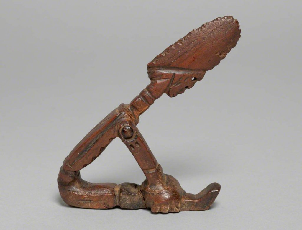
Perched Bird with Folded Wings by Tom Charman c.1919–1935
As he became better known, the popular psychic magazines of the time looked on him as something of an authority and The Occult Review of February 1917 featured an article titled ‘A Seer of Nature Spirits’, on Tom’s discoveries: ‘a form of life which passes us by entirely in our normal states of consciousness’.
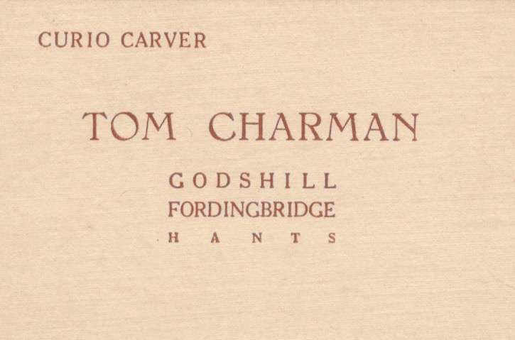
Tom’s business card
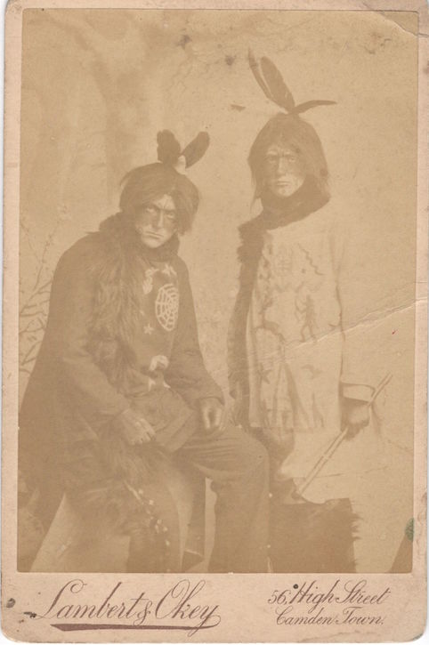
An exhibition of Tom’s carvings and stones was held at Brighton’s Old Sterne Hall (under the auspices of the Brighton Spiritualist Brotherhood, chaired by Countess Verneuil and attended on occasion by Sir Arthur Conan Doyle). Some 1,200 items were displayed which included ‘gnomes, lizards, snakes of all sorts, an Indian sacred beetle, a sea snail, and other weird objects…’ The report in the Sussex & Surrey Telegraph goes on: ‘He has seen Indians, clairvoyantly in the woods, and has reproduced some of them with almost uncanny exactness.’
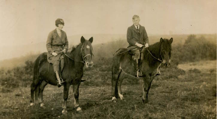
Margaret and Tom Charman on horseback, early 1920s
In the early 1920s, Tom fell in love with Ernest’s daughter, the 22-year-old Margaret, an Oxford anthropology graduate. Much to Ernest’s consternation and despite his strong objections, the relationship blossomed and eventually Ernest relented, passing the bungalow to Margaret and Tom who would go on to set up the Godshill Pottery there, with the assistance and instruction of Denise Wren of Oxshott Pottery.
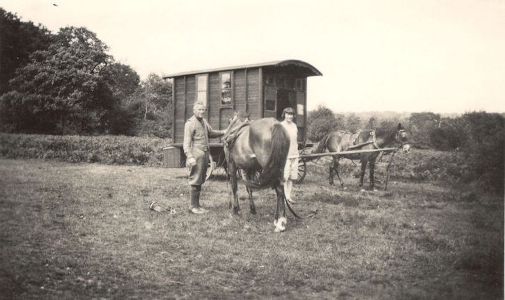
Tom and Margaret Charman with a caravan in fields at Robin’s Bush, New Forest, 1927
Tom and Margaret’s honeymoon – nine weeks camped in the Forest, living apparently on dry lentils and bloaters (a type of smoked herring) and, at first, accompanied by Ernest – was followed by a period on the road travelling in a Gypsy caravan. Finally, they returned to Godshill where all three set up home together. Ernest was tragically killed in London in 1922, aged 67, when he fell from the sidecar of his son Aubrey’s motorcycle as it struck a tramline.
Godshill Pottery on The Ridge, Godshill, New Forest in its heyday (currently closed)
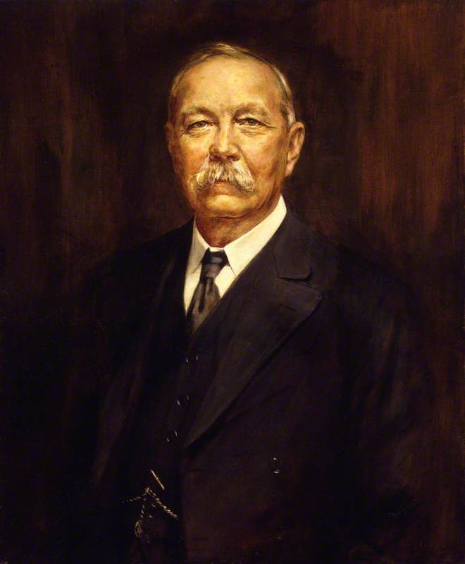
Sir Arthur Conan Doyle lived at nearby Bignell Wood, a large house at Brook, and was also passionate about the existence of fairies. Sir Arthur became a frequent visitor to the little house on The Ridge, along with others intrigued by Tom’s theories and experiences.
Oil painting of Sir Arthur Conan Doyle, 1927, by Henry L. Gates (1872–1943)
Tom was described by Conan Doyle in his popular book Coming of the Fairies (1922) as one ‘who builds for himself a shelter in the New Forest and hunts for fairies as an entomologist would for butterflies’.
Stylised Figure Seated Bent Over with Arms on Knees c.1919–1935 by Tom Charman (1863–1939)
Tom’s haunting yet engaging wood carvings, decorated stones and flints, and strikingly spontaneous drawings – occasionally in charcoal but mostly in pen and ink, and watercolour – brought Tom recognition at London exhibitions in the late 1920s and 1930s. He and Margaret attended the annual Artist Craftsman shows (arranged by the Knox Guild of Design & Crafts) at Central Hall, Westminster from around 1929 to 1935. There he displayed and sold his work alongside other famous arts and crafts devotees as well as at gatherings of followers of the spirit world.
Woodpecker on Branch c.1919–1935 by Tom Charman (1863–1939)
It is a tribute to the late Danae Stammers (Tom’s daughter) and the Charman family that this collection is now in the care of the New Forest Heritage Centre in Lyndhurst.
The full story of the life of Tom and Margaret Charman and their children Chris and Danae is told in Christopher Pan Charman’s 2019 memoir In the Spirit of Godshill, published by and available from Millersford Press.
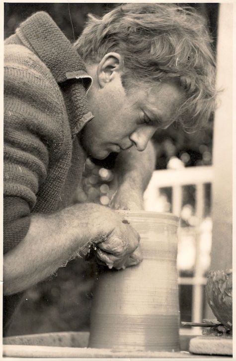
Young Christopher Pan Charman throwing a pot
A film of Chris Charman and his artist wife Kate – which includes Chris talking about his father’s carvings and how they revived Godshill Pottery – can be viewed on the Millersford Press website.
Sonia Aarons-Green, editor, writer and publisher at Millersford Press
The New Forest is managed as a working forest by the Forestry Commission, this includes the commercial growing and harvesting of trees. Most of this happens away from public eye, unless you happen to stumble across works happening in one of the inclosures on your walk or bike ride. However one of the times you get to personally appreciate this activity and even take a part of the New Forest home with you is at Christmas time. Picking out and decorating your very own tree can be one of the highlights of the festive season.
The tradition of having a decorated tree in your home is a rather recent adaptation for Christmas; whilst evergreen fir trees have been used to celebrate winter festivals for thousands of years, the Christmas tree in its current guise has only been popular in the UK since the nineteenth century.
The first publicly decorated Christmas tree on record was in 1510 in Riga, Latvia. The tree was put up by men wearing black hats who proceeded to first dance around the tree, and then set it on fire.
The tradition of decorated Christmas trees spread from Germany to the UK thanks to Queen Victoria and Prince Albert. German born Albert had often celebrated Christmas with a tree as a youngster, and was keen to share this childhood treat with his new wife. In 1848 the Illustrated London News published a drawing of the royal couple with a beautifully decorated tree, and within a few years the sight was common throughout homes in Britain.
Since then the popularity of Christmas trees has reached dizzying heights. The UK goes through around eight million real trees annually according to the Forestry Commission.
British Pathe has two videos dealing with the annual New Forest Christmas tree harvest.
The following paper was presented at the New Forest Knowledge Conference 2017 entitled: New Forest Historical Research and Archaeology: who’s doing it? Below you will find the abstract of the paper and a video of the paper given if permission to film it was given by the speaker.
Speaker:
Richard Reeves
This paper first outlines the changes in the bounds of the New Forest using evidence from the Domesday Book, medieval and later perambulations. It will consider the changes in and challenges to the perambulation that have occurred through the history of the Forest. In particular, the period around the time of the designation of the Forest and subsequent reorganization of the Saxon hundredal boundaries to form the New Forest Hundred coterminous with the demesne lands of the Forest. Also following the implementation of the Carta de Foresta of 1217 and the struggles for disafforestation surrounding it. It will then briefly cover the formation of the Bailiwick and Walk boundaries into which the Forest was historically divided.
The second section will consider the individual bound-marks of the perambulations, particularly in reference to archaeological features, including prehistoric barrows, Roman roads and other route-ways, as well sites near contemporary with the bounds themselves, focusing on those relevant to the historic management of the Forest.
Lastly, the impact of the various bounds will be considered in terms of historic management, in particular commoning, with special reference to purlieus both outside and within the Forest, impacts on the jurisdictional history, specifically the interest of the various types of forest officers and legal history of the Forest, and what this tells us about the more widely about forest law.
In summary it will demonstrate how the designation of the Forest impacted on the development of the Forest and its hinterland, thereby creating the landscape we see today.
Discover the remains of a Second World War bombing site in the New Forest National Park from the the air.
5000 acres (equivalent to 2833 football pitches) of heathland in the North of the New Forest was taken over by the Aeroplane & Armament Experimental Establishment (A&AEE) to become a training and testing range for all types of munitions fired and or dropped from British aircraft during WWII, except live incendiaries due to the fire risk.
https://youtu.be/hbk5Bs0W6hQ
The range consisted of several different target types including air to ground attack, mock ship targets, aircraft pens, gun emplacement, bomb fragmentation areas and the Ministry of Home Security target (known locally as the Sub Pens) as well as domestic facilities for crew, two small grass airstrips, observation shelters and towers. The range was split with one area for inert ordnance only. The site was also used day and night with one, the illumination target specifically for night raid practice.
On this site the Ashley Range Overview page has links to more detailed pages about the range targets, activities and stories from the people stationed here and the locals living nearby.
Discover the remains of a Second World War bombing site in the New Forest National Park from the the air.
5000 acres (equivalent to 2833 football pitches) of New Forest heathland was taken over by the Aeroplane & Armament Experimental Establishment (A&AEE) in 1940 to become its training and testing range. All types of munitions fired and or dropped from British aircraft during WWII were tested here first, except live incendiaries due to the fire risk.
The range consisted of several different target types including air to ground attack, mock ship targets, aircraft pens, gun emplacement, bomb fragmentation areas and the Ministry of Home Security target (known locally as the Sub Pens) as well as domestic facilities for crew, two small grass airstrips, observation shelters and towers some of which survive today.
On this site the Ashley Range Overview page has links to detailed pages about the targets, activities, archives and stories about the range.