

The Joy of Chains
Gunter’s chain
The original standardised measuring chain was created by the Reverend Edmund Gunter, a clergyman and mathematician who was a contemporary of Galileo. His chain, known as a Gunter’s or surveyor’s chain combined a blend of units- both decimal and imperial. This combination eased the computation of our old units.
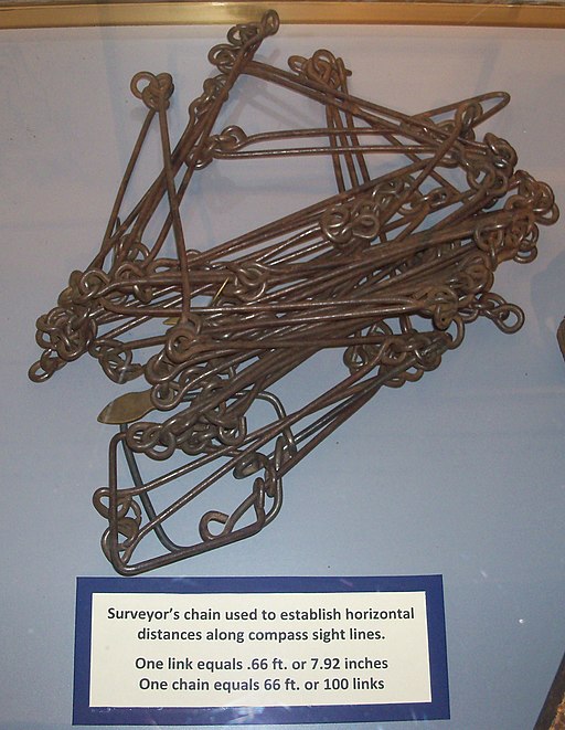
The chain has a length of 22 yards (66 feet). It is made of 100 wire links joined by rings which give the chain flexibility as it is being unravelled. The first and last link are shaped into a handle, but are the same length as the other links. Every tenth link has a marker attached to enable fractions of a chain to be easily counted.
The choice of 22 yards may initially seem strange but it has many benefits when using our pre-decimal units of measurement. Ten chains make a furlong. Eighty chains make a mile, and ten square chains make an acre. The fly in the ointment is that the chain measures 792 inches (22 yards x 36 inches). Each link is therefore 7.92 inches long.
The chain in cartography
Ogilby’s Britannia
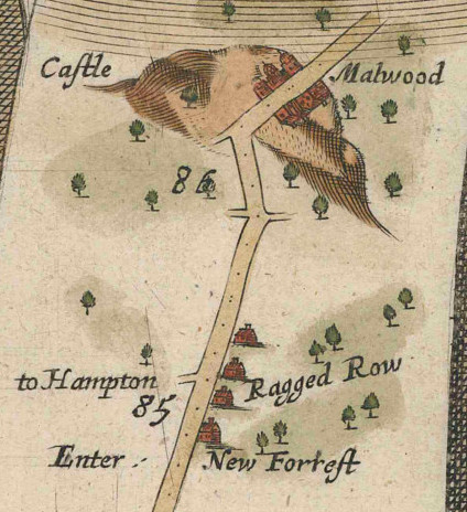
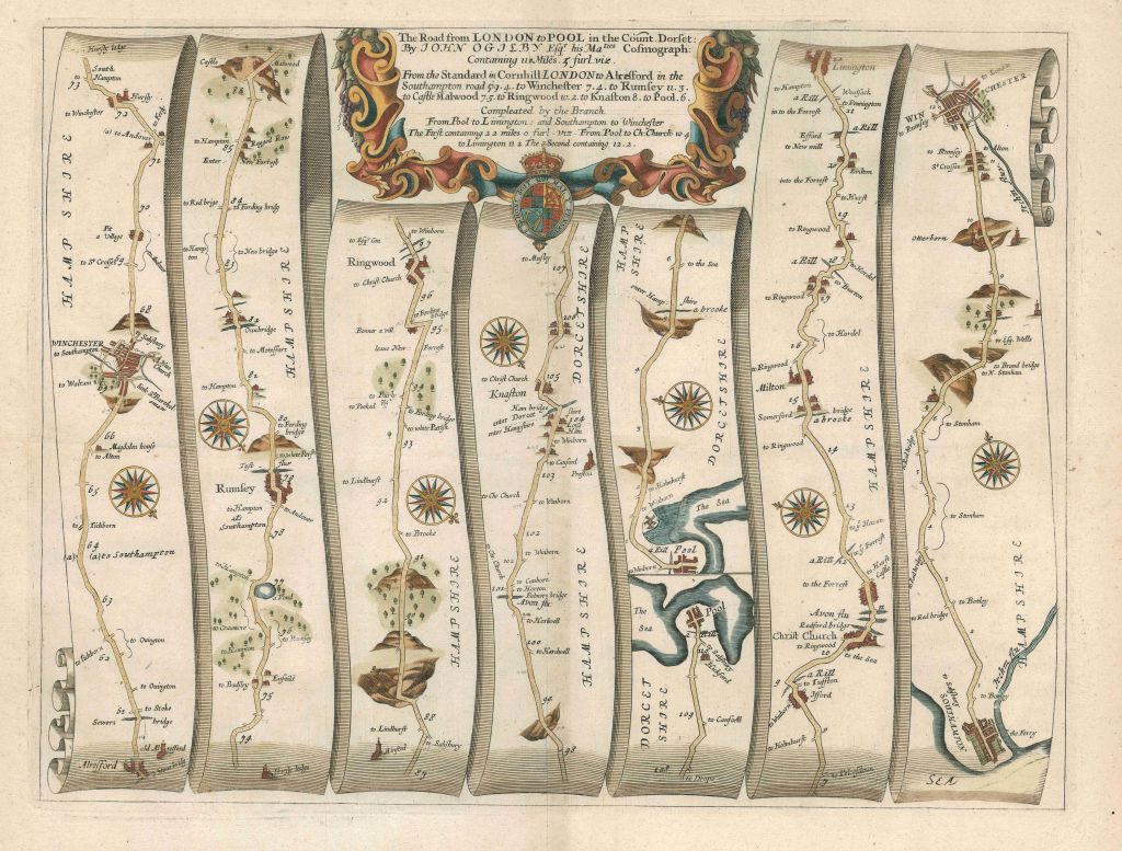
The map maker John Ogilby (1600-1676) used the chain as the base unit when he created Britannia, the first detailed and accurate road atlas of England and Wales. With its structured guided routes and detailed descriptions of hazards and points of interest along the way, it was a precursor to the present day satnav. He marked every furlong (10 chains) on his maps with a dot, and every mile with a double dot. Page 97 of his Britannia, is the last section of his route from London to Poole. It shows the journey from Alresford to Poole taking in a section of the New Forest. It is the oldest map in our collection.
Click here for a full image of page 97 of Ogilby’s Britannia,
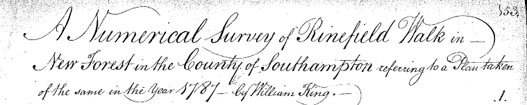
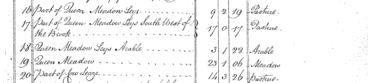
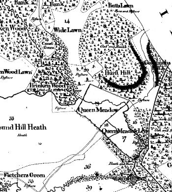
The Drivers’ Map
The 1789 map of the New Forest, known as the Drivers’ map was a forerunner of the Geographical Information System (GIS). This superb map, over 9 feet square, shows the land holdings in the Forest. But before it was published a detailed survey took place in 1787. Every parcel of Crown land was given an index number, measured and described in the survey, much as is now done digitally. These precise descriptions of the quality and quantity of pieces of land not only enabled the Forest to be valued but also identified future opportunities for development.
The measurement of the parcels of land is highly accurate, detailing the number of acres, roods and poles of each parcel. (A rood is one quarter of an acre, a pole is one fortieth of a rood, that being a quarter of a chain or 16.5 feet squared.)
These seemingly perverse and unnecessarily complex units have a curious saving grace. A simple algorithm allows measurements based on the link of a Gunter’s chain (7.92 inches) to be easily converted to acres, roods and poles. Without Gunter’s chain, the accuracy of the survey would have been far more difficult to achieve.
The Ramsden chain
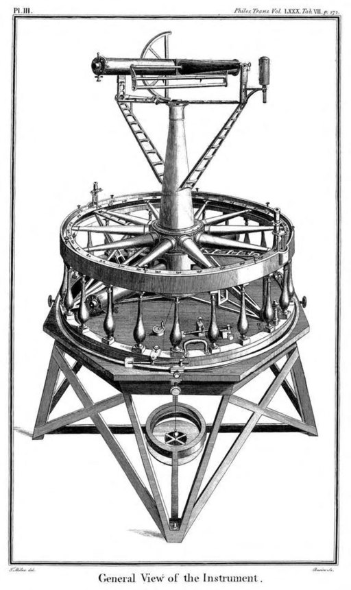
In 1784 George III agreed to a project to enable the relative positions of the Paris and Greenwich observatories to be precisely established. A theodolite was commissioned from Jesse Ramsden, the most prominent instrument maker of his day, to help with triangulation. While he was building it, a baseline some five miles long was established at Hounslow. Accurate measurement of this baseline was a matter of extreme importance. Any error in its calculation would be multiplied across the successive triangulations which were derived from it. Responsibility for implementing the project was handed to Major-general William Roy who had had a distinguished career surveying and mapping Scotland.
Ramsden also devised a new chain to help with the measurement of the baseline. It differed from Gunter’s chain by containing links that were made of steel rods, and instead of rings at the end of each rod there were joints that were similar in structure to a bicycle chain. This chain was used to obtain a rough estimate of the length of the baseline. The final measurement was made using three glass rods, twenty feet long and one inch in diameter. Such care was taken over this operation that the finished baseline, five miles long, was out by only three inches.
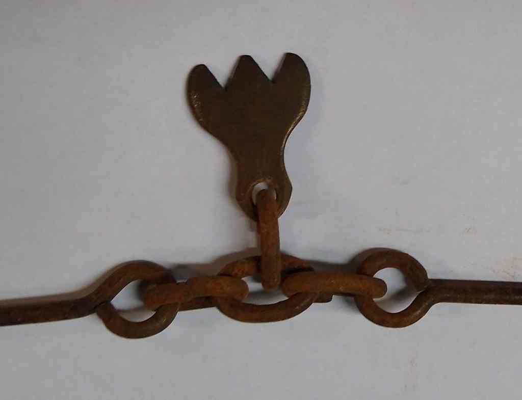
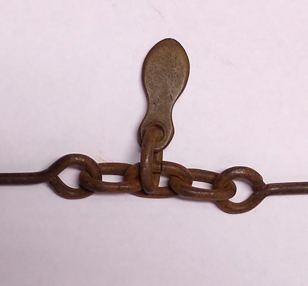
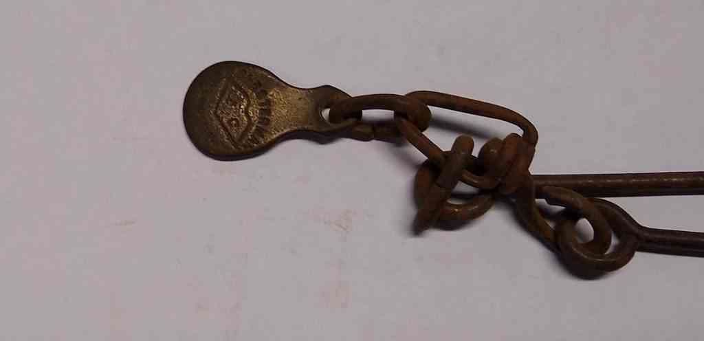
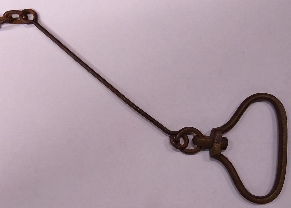
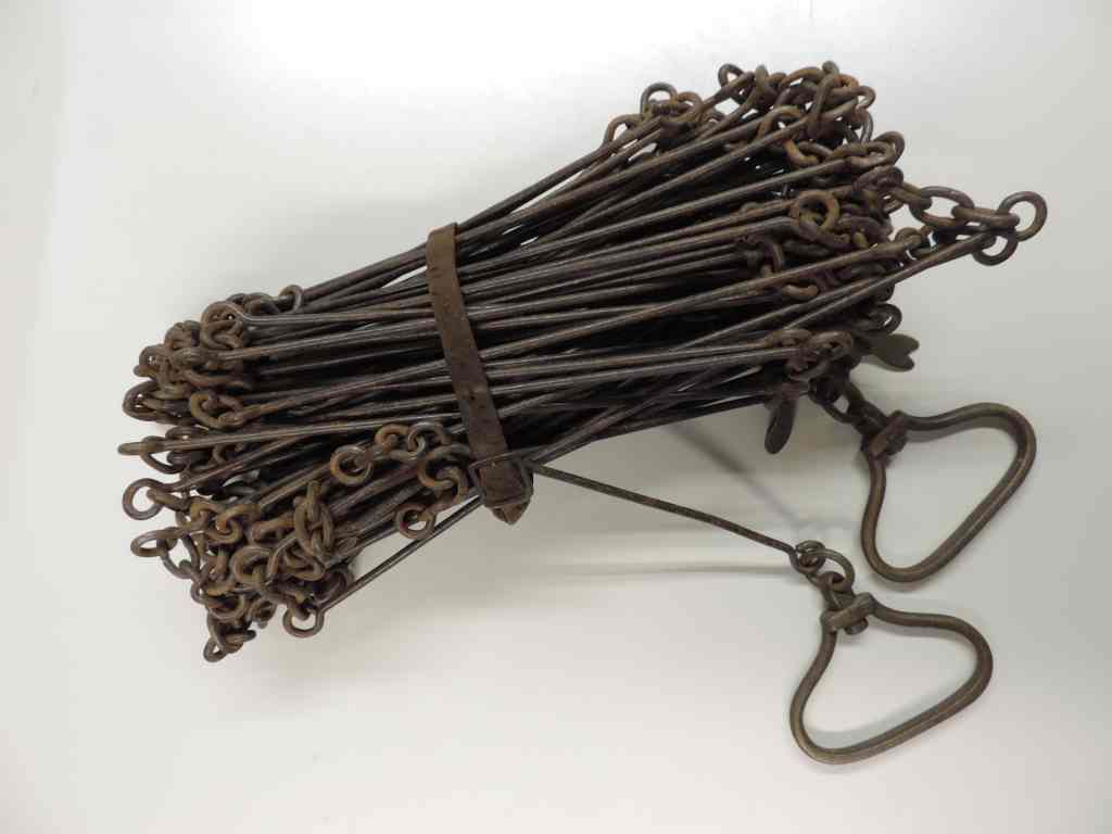
The Engineer’s Chain
Our recently acquired chain is not a surveyor’s chain but is an engineer’s chain. Its structure is similar to the Gunter’s chain with solid rods connected by rings, but each link is one foot in length, and the chain itself is made of 100 links. These chains became common in the 19th century and were used for building canals and, later railways. The chain was made by Chesterman’s of Sheffield, a manufacturer who specialised in a multitude of precision measuring devices. Chesterman went on to patent the spring-return linen tape measure and also invented the first metallic woven and steel tape, so speeding up the demise of his engineer’s chain.
The Chain Today
The chain remains a statute unit, defined in the Weights and Measures Act 1985. Its most common use now is in measuring the distance between the wickets on a cricket pitch (22 yards), and in dividing and sub-dividing allotments.