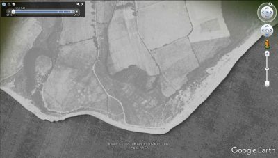
Lepe anti-aircraft battery
Zooming in to the site of Lepe Country Park on Google Earth and using the “Show Historical Imagery” button in the top tool bar one can see the 1945 aerial images series; the Ilse of Wight has full coverage. It also shows a section of the Lepe site and visible is a circular cluster of nine objects around a central double structure. They appear to be pits with a pale area surrounding suggestive of spoil. The pattern is suggestive of an abandoned temporary anti-aircraft battery, perhaps to protect the D Day invasion fleet.
This was not the structures seen eroding out of the cliff at Stone Point labelled as Stone Point battery.
These features were digitized as part of the WWII project. On the main New Forest Knowledge map select ‘Archaeology’ and then ‘National Mapping – Modern’ and you will see them along with the other WWII sites at Lepe, which you can find out more about here:
- D-Day at Lepe
- Drone tour of Lepe
- Pluto at Lepe – Leaves for the Isle of Wight
- Lepe launching ramps
- Stone Point Battery
You can also find out more from a talk given by Stephen Fisher at the New Forest Knowledge Conference 2017: Equipping the Armada: The archaeology of Lepe Country Park
Original article edited by Admin: 13/03/17


