

Where to park your D-Day Landing craft?

")
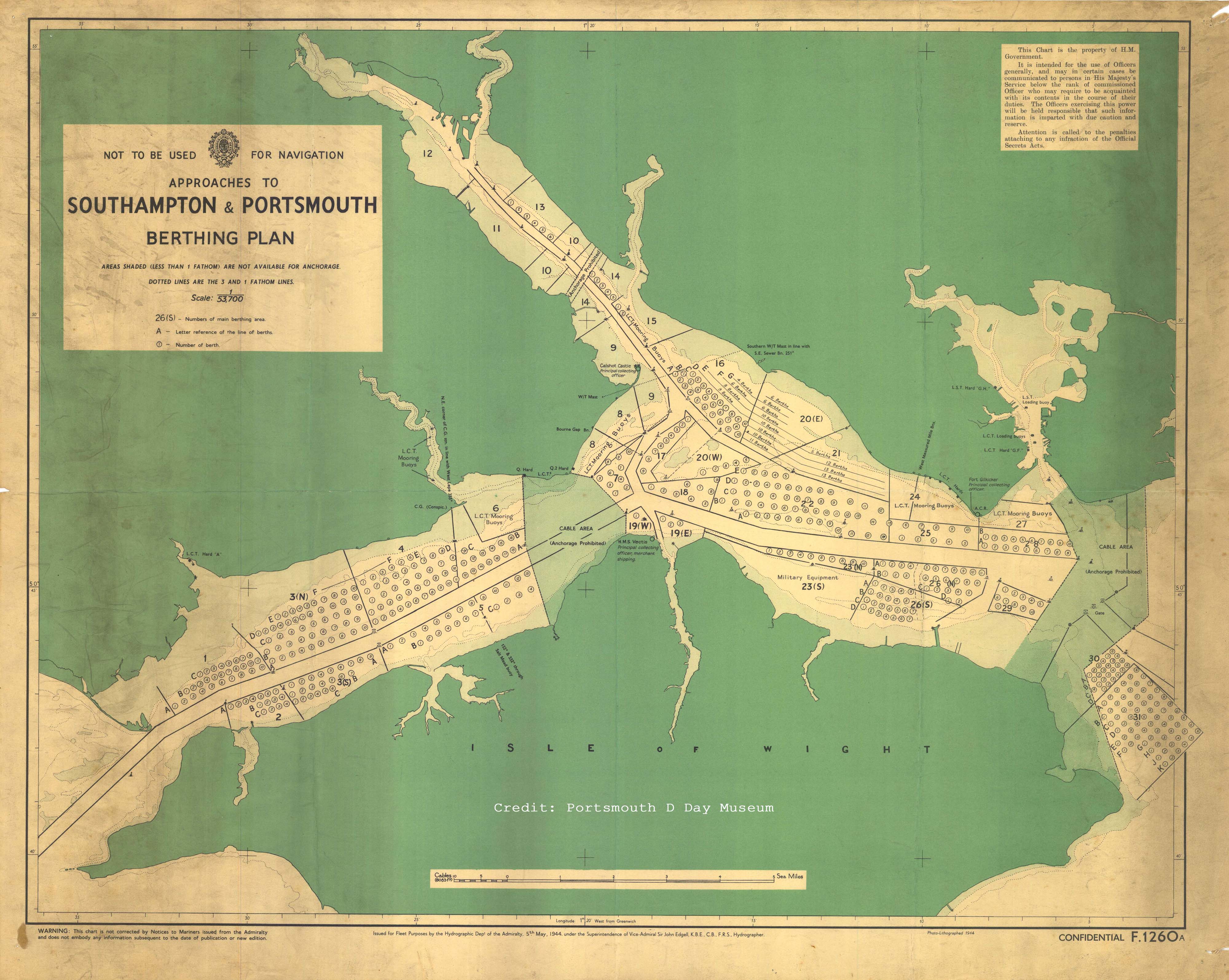
There are many stories about the sheer volume of men and machines residing in the New Forest during the build up to D Day. There was also a common story doing the rounds that a person could walk across to the Isle of Wight from the New Forest without getting their feet wet due to the sheer number of landing craft in the Solent.
These two maps are berthing plans for the Solent in the build up to D Day and show where the various landing craft would be moored. They do show that there was parking for numerous vessels. Unfortunately it looks like the bit about getting to the Isle of Wight might have been misleading due to the navigation channel left down the centre of the Solent for ships to move.
These maps are reproduced with the permission of: Portsmouth D Day Museum and St Barbe Museum & Art Gallery, Lymington. They show two different background maps, but both show the parking plan for where to moor your landing craft and hopefully find it again later on.
You can find out more about the New Forest’s vital role in D-Day from Mulberry Harbour, to holding camps, road widening, advanced landing grounds, PLUTO and Embarkation by visiting our main page on D-Day in the New Forest.