Buckland Rings: Drone tour and Geophysics
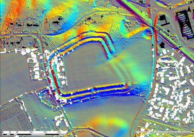
Recent scrub clearance and research at Buckland Rings Iron Age Hillfort has revealed its features both obvious and hidden like never before.
As well as the drone footage recent work by National Park archaeologists along with volunteers and students from Bournemouth University have been seeking to reveal more of the sites hidden history through geophysical survey
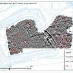
Up to seven pre-historic dwellings were identified, which would have once housed a community of hunters and farmers that would grow into the modern Lymington. Trading throughout Britain and across the sea, these ancient ancestors would have lived in round wooden buildings caked in a soil-based mixture. Archaeologists also discovered medieval field systems, helping them chart the evolution of the Buckland Rings community from prehistoric hamlet to modern day Lymington.
The team surveyed an area of 4.3 hectares, around six football pitches, to identify variations in the earth’s soil that show ancient human activity (below). These variations can be caused by the digging of ditches and pits as well as the burning of materials.
Lawrence Shaw, Archaeological Officer (project and data) for the New Forest National Park Authority, said: ‘Buckland Rings is a fantastically well preserved hillfort that would have once towered over Lymington and even been visible from the sea. ‘This project has allowed us to look back at the origins of this historic town and see how people were living thousands of years ago. We hope to continue with our research to uncover more details of early Lymington and help the local community to find out more about this fascinating site.’
The work was undertaken as part of a work placement project by Bournemouth University archaeology student, Josie Hagan, who said: ‘This survey was a great success and we had a lot of fun over the six days. The volunteers and students worked extremely hard to get a lot of ground covered, and this looks great in the results. It makes it all worthwhile when you get to piece the results together and see features that haven’t been discovered before.’
You can download the full report here: Report of Results from Geophysical Survey at Buckland Rings
Further Survey
Following the success of Josie’s Geophysical initial survey further research and non intrusive survey has been commissioned and undertaken on the site to try and build the best picture of what lies beneath the surface without digging. You can find out more about these on their own pages
- Buckland Rings Electromagnetic Induction Survey (EMI) – forthcoming
- Buckland Rings Ground Penetrating Radar Survey (GPR)
The Site Today
Buckland Rings is a Scheduled Ancient Monument (List Entry Number: 1008706) owned and managed by Hampshire County Council that is open for the public to explore. Visitors are encouraged to respect this special site by clearing up after their dog and not undertaking metal detecting.
As well as ongoing research the site has recently benefited from the installation of interpretation thanks to a spudyouth project. The new trails, panels and art installations help make this fascinating site even more special for visitors. You can find out all about their project, the research that went into it and the results here: spudyouth Buckland Rings
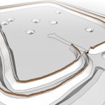
Students from Bournemouth University’s Games Technology degree have also worked on this site to create some interpretation models which you can enjoy in the following article: Modelling Buckland Rings


