

Matley Heath Archaeology: Drone tour
Join us for a drone tour of Iron Age and Bronze Age sites at Matley Heath in the New Forest. These are just some of the thousands of historical sites we work to protect every year.
Bournemouth Archaeology have been commissioned to undertake a large geophysical survey of the two sites to see if we can learn more about them and the New Forest landscape they reside in. Results to follow.
The area comprises of two scheduled monument areas
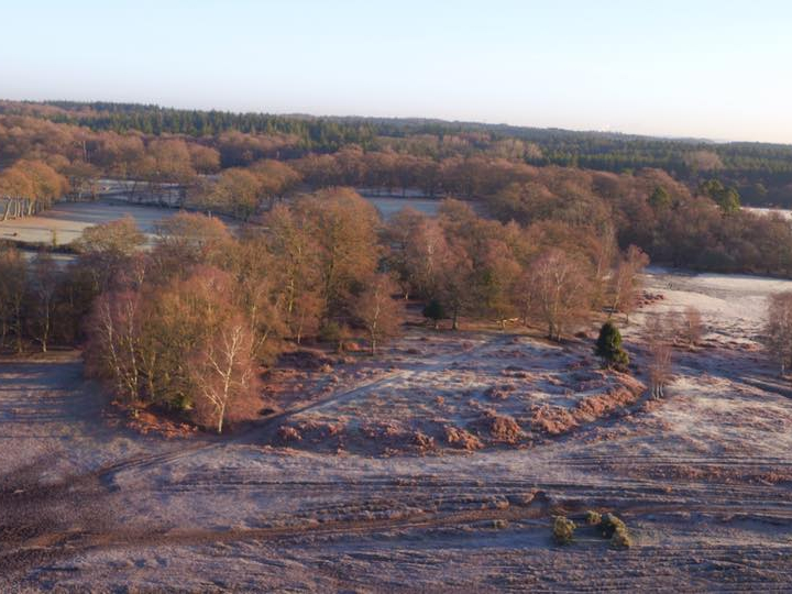
Hillfort 400m south of Home Farm
The monument includes a slight univallate hillfort situated on the top of a sandy knoll immediately south of a stream within the New Forest. The hillfort is sub-circular in plan and has ramparts 1m in height and 3m in width which enclose an area of approximately 0.3ha. An external ditch up to 3m in width and 0.9m in depth and a slight counterscarp bank are visible around the eastern, western and southern sides of the rampart. On the northern side of the hillfort the rampart utilizes the natural scarp and has no obvious external ditch, although a depression 7m in length, 0.2m in width and 0.3m in depth projects northwards from the base of the scarp. A break in the eastern rampart 7m in width and a 4m wide causeway over the ditch probably indicate the original entrance. The area enclosed by the rampart is undulating and includes a mound 11m in diameter and 0.9m in height situated against the southern bank. The hillfort has been partially disturbed by a trackway which bisects it on an east to west axis.
Bowl barrows and a bell barrow on Matley Heath
The monument includes a cluster of three round barrows situated on a north to south orientated ridge overlooking the valley of the River Beaulieu. All three barrows have a hollow in the centre of the mound suggesting previous robbing or early partial excavation. The eastern bowl barrow mound measures 15m in diameter and stands up to 1.5m high. A ditch, from which material was quarried during the construction of the barrow, surrounds the mound. This has become partly infilled over the years but survives as a slight earthwork 1.5m wide and 0.35m deep. On the north-eastern outside edge of the ditch a slight bank measuring 2m wide and up to 0.2m high survives. The northern bell barrow mound measures 6m in diameter, stands up to 0.9m high and has a 3.25m wide berm. The ditch has become partly infilled but survives as a slight earthwork 0.8m wide and 0.15m deep. The western bowl barrow mound measures 15m in diameter and stands up to 1.8m high. The associated ditch survives as a 1.6m wide and 0.4m deep earthwork which is particularly pronounced on the south edge of the mound.