

Written by Hannah from Lyndhurst PTA 06/10/2024
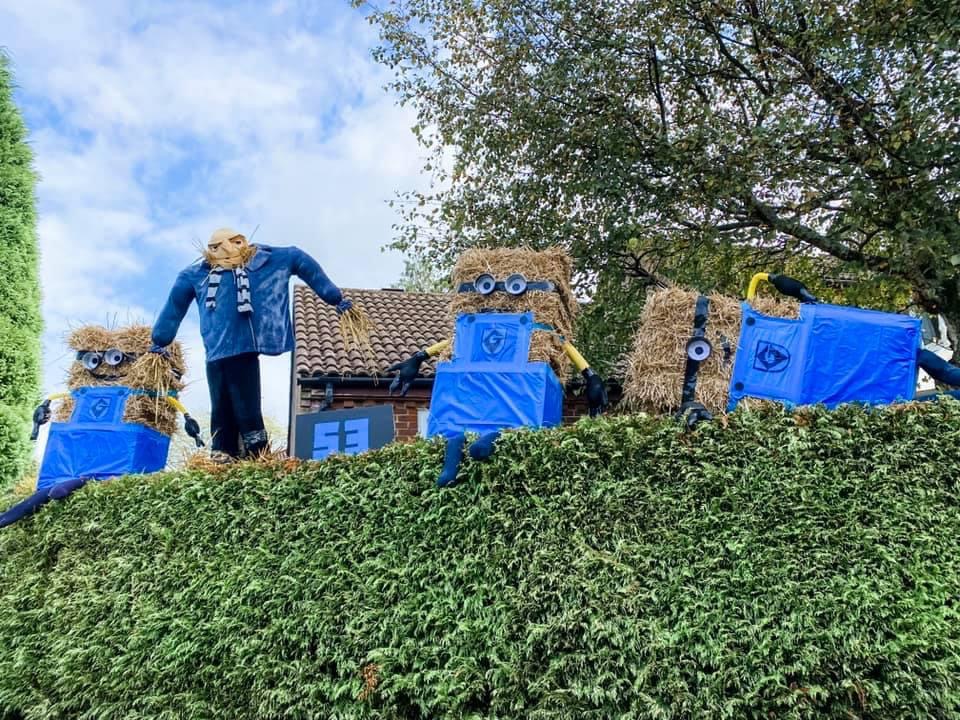
It first started in 2021 as a way to raise some money for the local infant school St Michael & All Angels in a way that was covid friendly as it was still a little bit like that at the time. The first year we had around 50 scarecrows and raised £1273 for the school. The event blew us away in how popular it was. We had 250 maps printed for it which sold out the first day and we spent a manic Saturday night trying to beg anyone local with a colour printer to print us some copies. During and after the trail there was growing feeling in the village that we simply HAD to make it an annual event. Due to people coming into Lyndhurst to hunt down the scarecrows there was a real boost in trade for all the local businesses on the high street too which was an unexpected bonus. The winner of our first year was ‘Gru and his Minions’ which was an epic creation on display in Haskells Close.
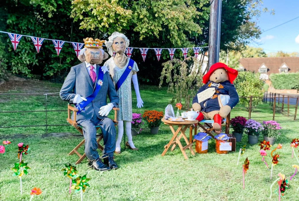
The 2nd year we had 85 scarecrows and raised £1800. The worthy winners of the 2022 trail were King Charles, Camilla and Paddington who were on display on the green in Forest Gardens. The residents of this street club [came] together to create their entry and also sold homemade cakes and marmalade to raise additional funds for the school. The community spirit was really out in full force this year.
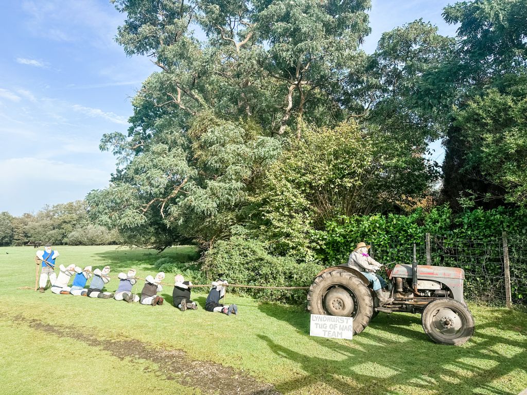
It returned again in 2023 with 80 scarecrows and the addition of the Barn Dance held at The Stag, Lyndhurst. On the Saturday night of the trail weekend they had a traditional Ceilidh band and this saw villagers old and young all come together to dance and have fun, it was a great night that raised over £200 for the trail. Forest Gardens did us proud again and held a Mad Hatters Tea Party. Along with their amazing scarecrows of Alice and friends they served sandwiches, cakes, drinks and more to raise an incredible £837.50 for the school! The total raised for the 2023 trail was an amazing £3144 and the winner was ‘The Lyndhurst Tug of War’ featuring no less than 9 scarecrows!
The donations we have raised have contributed to an outside library for the children at St Michael’s, funded much needed new iPads for the school, a new reading scheme, paid for pantos and discos put on for the children and more. This year the 20 year old tricycles are in desperate need of replacing as they are not fit for use so we hope to use the money from the trail to pay for them.