

Roads Made Easy

For recently empowered motorists focused on their destination and unwilling to stop to make enquiries, the strip map was a practical choice for navigation. Roads Made Easy developed the concept so that the page simply showed information when it was relevant. An index map at the front of the book showed what routes were included.
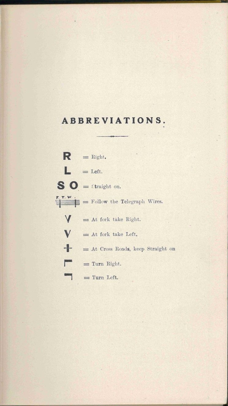
There was no scale, just an assumption that you drove straight on until a change was required. This minimised the paper consumed. A short hand system showed the direction of turn needed: left, right or straight on. Telegraph wires provided landmarks, along with pubs, churches and there were photographs of junctions where there might be any doubt.
One volume covered the main routes across the country south of a line drawn between London and Bristol.
Johnson, C. and Montagu, J. 1907. Roads made Easy by Picture and Pen. London: Car Illustrated. G.030 SC